I decided I'd better get to Episode 2 before I got busy changing locale. I think I've decided on my next spot....about 30 minutes south of Manistee.,,and free, of course. The Fourth of July being Wednesday makes it all a little if-y as far as available spots go, but it's supposed to rain the 4th and 5th, so I'm hoping that will deter most campers. Why move? Like virtually all National Forest dispersed camping sites, there's a 14-day maximum stay. I will hit that on Thursday. The Ranger has driven by at least every other day, so he knows how long I've been here. Once I find another good spot, that will hold me over until I return to home base. And, it's a balmy 79* today - 65% humidity...a great day to be able to focus on the blog and not on how ungodly hot it is!
So, we left off at The Point Betsie Lighthouse in Frankfort, MI. The additional go-to site is outside of Empire, MI....about 30 minutes on up the shoreline of Lake Michigan on Route 22. And off we went!
Not far from Frankfort, I saw a sign indicating another public access point to yet another lake....

In keeping with my "why not??" mindset, we ventured down the little lane to Platte Lake. These "public access" areas really mean "small boat launch" areas. It's not like there are a bunch of picnic tables and beaches. They are small turn around gravel areas simply carved out where you can launch a relatively small fishing boat, kayak, or canoe.


I would say the majority of people who live around these areas do so for the lake access...there are a lot of lakes! They might be year 'round or maybe just have a little cabin-like place for the summer. That would be nice! All along 22 are little lake houses...many utilized as rentals.
Back onto Route 22 heading north.....yes, you guessed it! In a few short minutes...


There is virtually no one on these lakes! They are all beautiful!
Are there more?
Well.......yes!

Loon Lake is actually part of the Manistee National Forest.
The others are probably county lakes.

That's all the lakes for now. They might all look the same from the photos, but each one was different in it's own way. We added onto our 30 minute drive a little, but after another few minutes of rural landscape....

now we're finally in
Empire, MI
Empire is another "one-main-street" kinda town (pop. about 400). It is charming with little shops and tourist-attracting venues. The houses along the main drag are small, colorful and quaint. Empire thrives on tourism.


And you don't even have to go into the forest to see wildlife!
She was prancing right down the main street....I caught her just as she headed into the "burbs".

Check out Empire MI - Things to Do! for a host of activities and destinations around Empire. If you love the outdoors, this would be a place to put on your bucket list. On that things-to-do list is our destination...

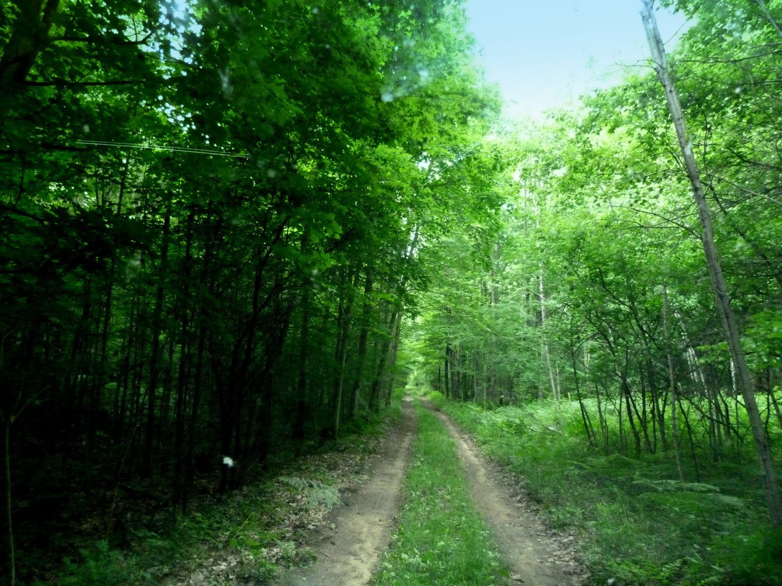
This is part of the Sleeping Bear Dunes National Lakeshore, i.e., a National Park. Admission is $20 for the 7.5 mile drive, unless you have a National Parks Pass, which I have, then it's free! The drive takes probably about 45 minutes, but you can go at your own pace. While we were there, it was never backed up with a line of cars like you see in Yellowstone, for instance. Not to say it would never be that way, but on this Thursday, it was fairly sparse and those that were there moved along. Between stops at look outs, the one-way drive was richly shaded forest of primarily beech and maple trees.

At almost the beginning of the trek was this cool covered bridge...

The road, and this covered bridge, was built in the 1960s and finished in 1967 by Pierce Stocking.
A lumberman with road-building experience, he wanted to share the
beauty of the area with others. He operated the facility until his death
in 1976; afterwards it was purchased by the National Park Service and
added to the park. In the 1980s, a two-year program reconstructed the
roadway and added a number of features for visiting tourists. In 2011,
the morning show Good Morning America
named the Sleeping Bear Dunes, and Pierce Stocking Drive, as the "Most
Beautiful Place in America" after a viewer poll on its website.
This first overlook stop is Glen Lake. It's actually two lakes, being divided by the M-22 causeway. Big Glen Lake is 130 feet deep in places, while Little Glen Lake is only 12 feet deep. (See the different water colors?) The long running ridge in the forefront is "Alligator Hill"...the snout supposedly is at the bridge dividing the two lakes. I guess I can see that!

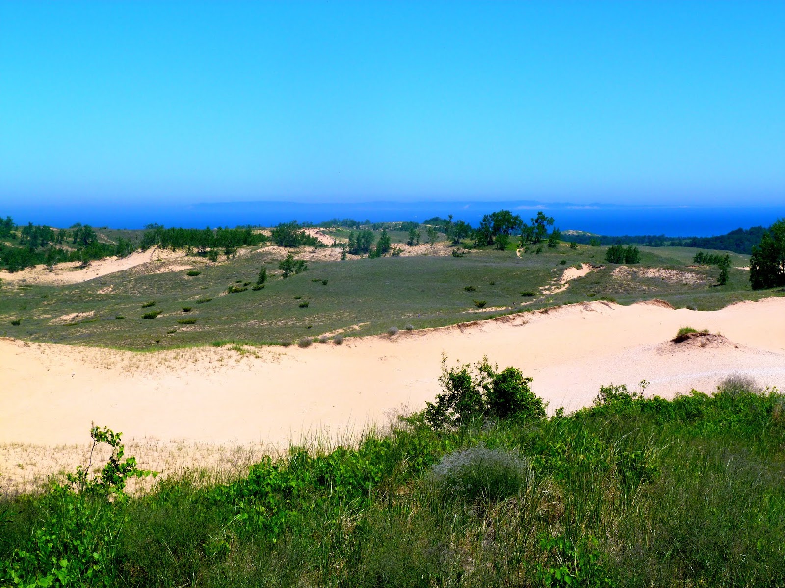
Next stop -- The Dunes!
This area encompasses about 4 square miles with Lake Michigan in the background


From the same lookout, just to the right is this perfectly situated farm.
Looked like a postcard...and really, almost unbelievable.

The next several stops were trails and some ecology placards. I'm sure they are of interest, however, with Bo waiting for me to stop taking photos and being a "tourist", we went on to the next overlooks -
a combination of the Lake Michigan Overlook and the Sleeping Bear Dune Overlook.


Standing on the overlook platform, you are about 450 feet above the lake.

This next photo was taken from the path that was already 450 feet above the water...

That little white dot in the next photo is my favorite type of boat...a sailboat.
It was a perfect day for sailing!
It was a perfect day for sailing!


It's amazing anything can grow in all this sand!

Finally, the last stop on this great scenic route was the overlook for
North Bar Lake.
There's a beautiful little, shaded picnic area at this stop.

From this overlook you see a rare type of geologic remnant. Once a bay of Lake Michigan, its name describes how it is slowly closing itself off as the sand bar along its west side continues to build up.

That ends the Pierce Stocking Scenic Drive. It is well worth the $20 admission. It would be a fantastic drive in the fall when all the maples are turning!
That doesn't quite end this post, tho'. I took a different route back to Manistee...just to see what it offered. More rural landscape and picturesque structures...


...and a pass right through Bear Lake, Michigan....
no "public access" lane to see this lake!


Driving on, I knew Crystal Lake was connected to both Rt 22 and Rt 31...it's huge! It's the ninth largest inland lake in Michigan. 8 miles x 2.5 miles, or 9,854 acres. The deepest point is 165 feet. Frequently there are "white caps" on this lake. So, we got off Rt 31 at Beulah, MI because this was probably going to be the best view on this smaller end of the lake. (Ultimately, it was the last viewing town.) In 1873, an effort was made to connect Crystal Lake with Lake Michigan. When the channel was opened, the water level in Crystal Lake dropped about 20 feet. The project didn't actually succeed, but the lowering of the lake level uncovered sandy beaches, including the current public beach in Beulah.


The water here was like the Caribbean!
"Crystal" clear!

I didn't really take any time to observe Beulah, but from a quick glance, it looked worthy of a return visit. One main street, again...little shops, cafes and such. A good little day trip. Or stay in a lake side Bed & Breakfast!


Ok --- we're finally back on "home turf" after a very big road trip day! We saw soooooo much! Bo was a good traveler, albeit bored, I'm sure!
Yesterday, on the suggestion from a Deputy in the Sheriff's department who came through the campground a few times, we took off looking for some campsites within the National Forest about 20 miles north. DISASTER!! As I sometimes reminded everyone while I was RVing....it's not all fun and games! Following Google Maps, we were looking for Upper River Road near Brethern, MI. Yeah, it was on the map, but don't always think these GPS/phone maps know the best route! The first part was fine, then we had to turn on this road......
Based on prior experiences, I was wary, but I ventured onward anyway. Probably about a mile. Then it seemed like the road just ended -- unless maybe you were in a Jeep. This guy told us to "GO BACK"!! He was standing right where there was no tomorrow!

Fine! I'll go back....I get it! However, look at this road again....no where to turn around! Good thing I know how to use my side mirrors! Back we go.....BACKWARDS! I know this view looks the same as the view going in, but this was where we had been...the mile seemed like a hundred miles!

This was taken in my side view mirror.....finally we see the road where this all started....
we made it back to civilization!

I did find the road we were looking for as I knew it was near the Tippy Dam Recreational Area. I did find the obscure signs for the campsites and followed them. The lanes to these campsites were virtually impassable. The Deputy failed to mention that part. I mean, undriveable! Huge pot holes and ruts. And, these little lanes just jutted off from one another all over the place. At some points, I had no idea where I was. And there were very, very few places to turn around and even those were difficult. The campsites I did see were extremely secluded, but there was no way I was going to drive on those lanes again! I'll only go so far for a free campsite! So far the day had been a giant waste of time, energy and gas. But, you'll have those days. Sometimes the "why not??" mindset should be totally discarded! So be reminded that amidst all the pretty pictures there are pictures of....

Ready to get outta there, I decided to take a look at The 5th Avenue Beach since we were already out. It was going to be some extra mileage back into Manistee, but I needed ice for my little supplemental cooler anyway. At the Shop N Save it's only $3.69/20 lbs. vs. other stores where it's $4.75-$5.75. Plus, I had promised I would show you that beach!
You have to go through a VERY upscale little area to get to this beach so I wasn't surprised when I saw a very commercial-type beach with nice concession buildings and cool play stuff for kids. It was typically "crowded" I guess, but it was the weekend. There was a nice view of the lighthouse that we saw from The 1st Avenue Beach and overall, a very nice beach. But, I only stayed a minute. It was hot, Bo was tired, and we just needed to get back "home" to our familiar campsite.


Finally, the end of this long blog post! Hopefully it will be enough to hold everyone over til the next one. Right now, I have no idea when that will be, or where I will be posting from....if there's even going to be internet wherever I land....that's always a big question mark!
So, until then, everyone have a great, and safe, Fourth of July on Wednesday!
Thanks for tuning in and going on this Michigan road trip adventure with us!

Great trip for us! Many nice lakes and cool little towns. Thanks for posting!😎
ReplyDeleteWonderful! Thanks for posting!
ReplyDeleteLove the National Park Pass! Glad you made use of it.
ReplyDelete